Google's experimental
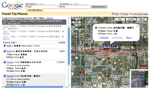
trip planner is now available for Japan. Unlike Google Maps that shows driving directions, Google Transit is useful if you want to use public transportation, but the number of places where you can use it is really small (10 cities in the US and now Japan).
Google Transit is also available for
mobile phones.


This is great !
ReplyDeleteI was waiting for Google to get on with the train fare business.
Detailed info about train schedules is already available through other sites in Japan, having Google provide it with maps is pretty useful.
I'd like to see Google pay more attention to European cities. Paris especially. :-)
ReplyDeleteNew York!!!! For the love of god please give us NEW YORK!!!!!!
ReplyDeleteI'd love to see something like this in Europe - I hope they're working on it! I'd especially like to be able to get directions by train from place to place complete with the times - at the moment it only shows direction by road... It would be a start for them to at least label train stations in the UK so I can find them on the map! They have them marked in London along with the Underground stops, but the rest of the UK has nothing of the sort.
ReplyDeletehave a look at map.search.ch - we don't have to wait for Google to do this...
ReplyDeleteThe difference between Google Transit in Japan and Google Transit in New York: You will actually get accurate time estimates for Japan. Down to the exact minute. In New York, you get ultra-fuzzy time guesstimates at best.
ReplyDeleteI'm hoping Google takes this one step further and adds Bicycling and Walking direction modes. I figure these modes could have a few extra features that would make this very useful and encourage folks to try such alternatives:
ReplyDelete- Take a bicyclist's/walker's special route needs into consideration, selecting roads on less busy streets (no freeways) when possible, accounting for the presence of sidewalks and routes through parks, and showing vehicle MPH limits on route segments.
- Show estimated travel time for an average bicyclist's/walker's MPH, possibly with options to enter your own values.
- Show a linear "height map" chart of the terrain one will be traversing, and optionally select flatter or hillier routes preferentially.
- Include hiking maps geodata (trails data) and allow plotting hiking routes.
- For a given route, indicate calories burned biking/walking, gasoline saved, and the (calories burned biking/walking : calories burned in the form of vehicle fuel) ratio over a given route -- would be very interesting and inspirational to see and compare.
- Integrate with Trip Planner's bus routes, so that you could indicate whether or not you will be bringing a bicycle on your bus trip, and how far you're willing to travel on foot/bike, and Google would then give biking/walking directions between your start/endpoints and the bus stops.
Have been using this function (called Google Local / Transfer) on my mobile probably since January 2007. Unfortunately, it is still not at the same level as Yahoo's Trains, EkiExpert or other services already available in the market.
ReplyDeleteHaven't used the desktop version yet, but if Google could add maps on their mobile version would be great.