How to add the mashups to Google Maps? With mapplets, mini-applications similar to Google Gadgets. "Mapplets are mini-webpages that are served inside an IFrame within the Google Maps site. You can put anything inside this mini-webpage that you can put into a normal webpage, including HTML, Javascript, and Flash. Google provides a Javascript API that gives the Mapplet access to services such as manipulating the map, fetching remote content, and storing user preferences."
There's already a test page that features some mapplets and they're pretty impressive: real estate search powered by Google Base, distance measurement, movie showtimes, weather, earthquake information and more.
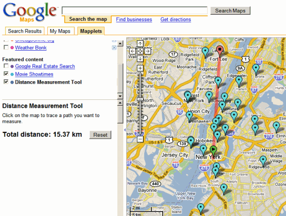
The nice thing is that you can activate more than a mapplet at a time, so you can see the movie showtimes for Shrek 3 in your area and measure the distance between two locations, like in the screenshot below.
Find more about the new "mashup of mashups" from this demo:

Anybody know how the distance mapplet work? Is it as simple is using the distance formula on the lat/lng coords and then multiplying by a constant to get from lat/lng degrees to meters? Or is there some trickery involved due to the curvature of the earth? Does anybody know?
ReplyDeleteIt uses the great circle distance, which is the distance along the surface of a spherical approximation to the earth:
ReplyDeletehttp://en.wikipedia.org/wiki/Great-circle_distance
Google Maps added bus stop information with time tables to the Austin, TX area.
ReplyDeletehttp://www.brandonkraft.com/weblog/archives/2007/05/google_maps_tra.php