The latest beta of Google Earth 4 includes a feature previously available only in the paid versions: drawing tools. "The path and polygon drawing tools are now available in the free product. You can easily sketch figures on the imagery for richer annotations and can share these overlays as KML or KMZ files."
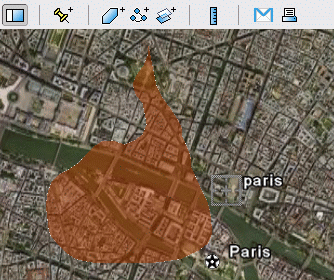
You can use these tools to mark some regions on the map.
There's also a way to measure distances between two locations and the length of a path. Just click on the ruler, define your path using the mouse and see the distance.
The latest version of Google Earth is
available here.

Did you try if the resulting KMZ files are Google Maps compatible (the drawings, that is)?
ReplyDeleteNice. Hopefully their next step will be to allow you get the length of existing paths, otherwise I can easily see myself not bothering to renew my subscription next year.
ReplyDeleteAlso time animation has been added to the free version. Fire maps example
ReplyDeleteThe answer to Philipp's quertion is yes, like this example illustrates.
ReplyDelete